The University of Washington Tacoma's
Master of Science in Geospatial Technologies
Program Overview/Info
The University of Washington Tacoma is one of the major Institutions located here in Tacoma, WA.
Below is a link that will direct you to the University of Washington Tacoma's Master of Science in Geospatial Technologies homepage, for more in-depth information about the overall program. Please follow the link if you are interested in finding out more information.
What is GIS?
'A geographic information system (GIS) is a framework for gathering, managing, and analyzing data. Rooted in the science of geography, GIS integrates many types of data. It analyzes spatial location and organizes layers of information into visualizations using maps and 3D scenes.'
-ESRI
Google Maps
Below is a basic Google Map. There is also a marker that was added to demonstrate I know the basic functions of how to build a web map and drop a pin using Google Maps API, in a web-based map. The marker has a simple label of "UWT" and is positioned on the University of Washington Tacoma. Zoom-in to see where the pin is placed!
What is Geospatial Technologies?
Geospatial technologies are systems that acquire and handle location-specific data about Earth. Remote sensing, the global positioning system (GPS), and geographic information systems (GIS) are important geospatial technologies. Remote sensing and the GPS are methods for collecting information about Earth's surface; GIS ia a mapping tool for organizing and analyzing information.
-AAAS.org
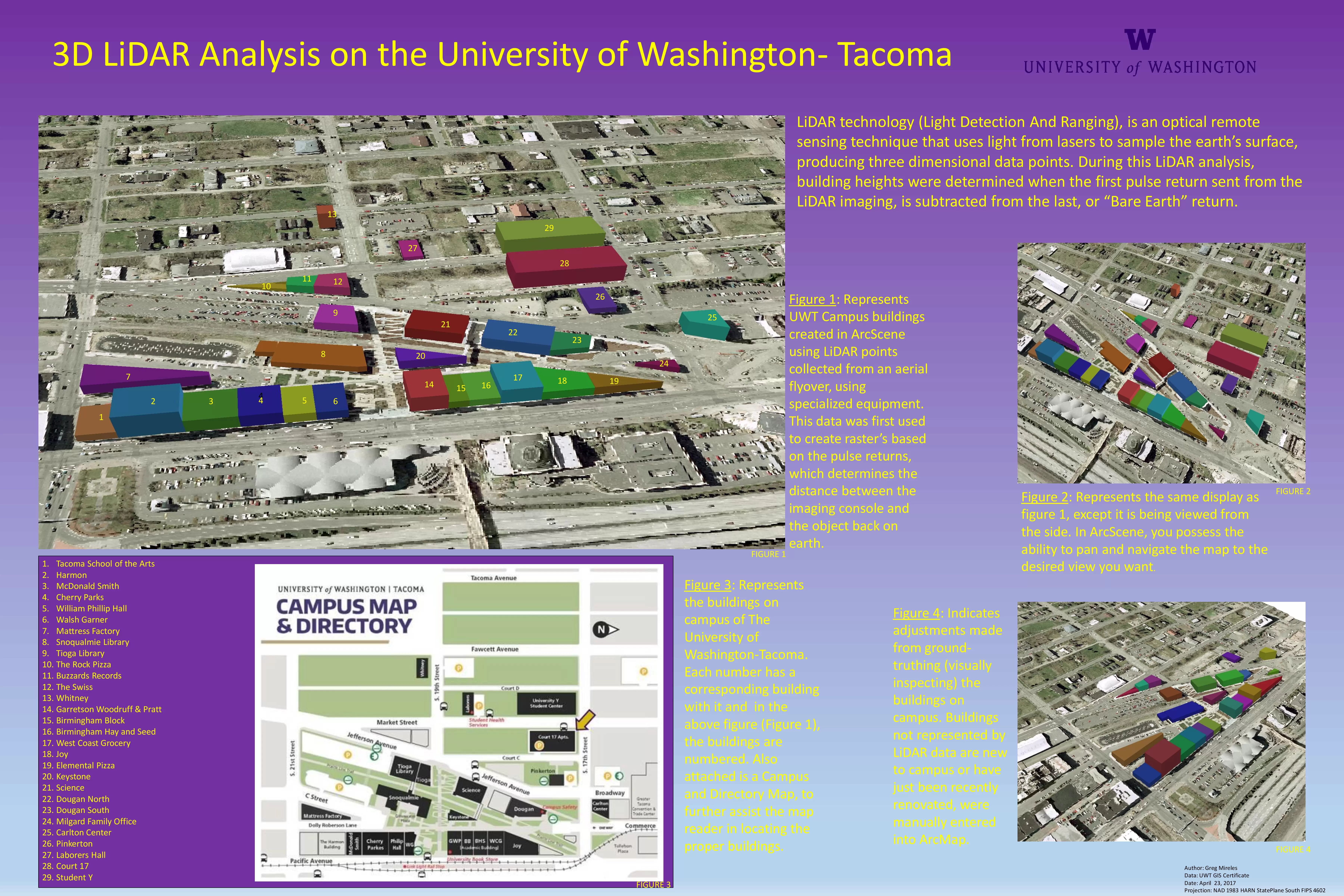
Below is an archive of past analysis and cartography.
As the MSGT projects or Capstone project
are either revised or completed, they will be posted below.
For more information on each project,
please follow the link below.
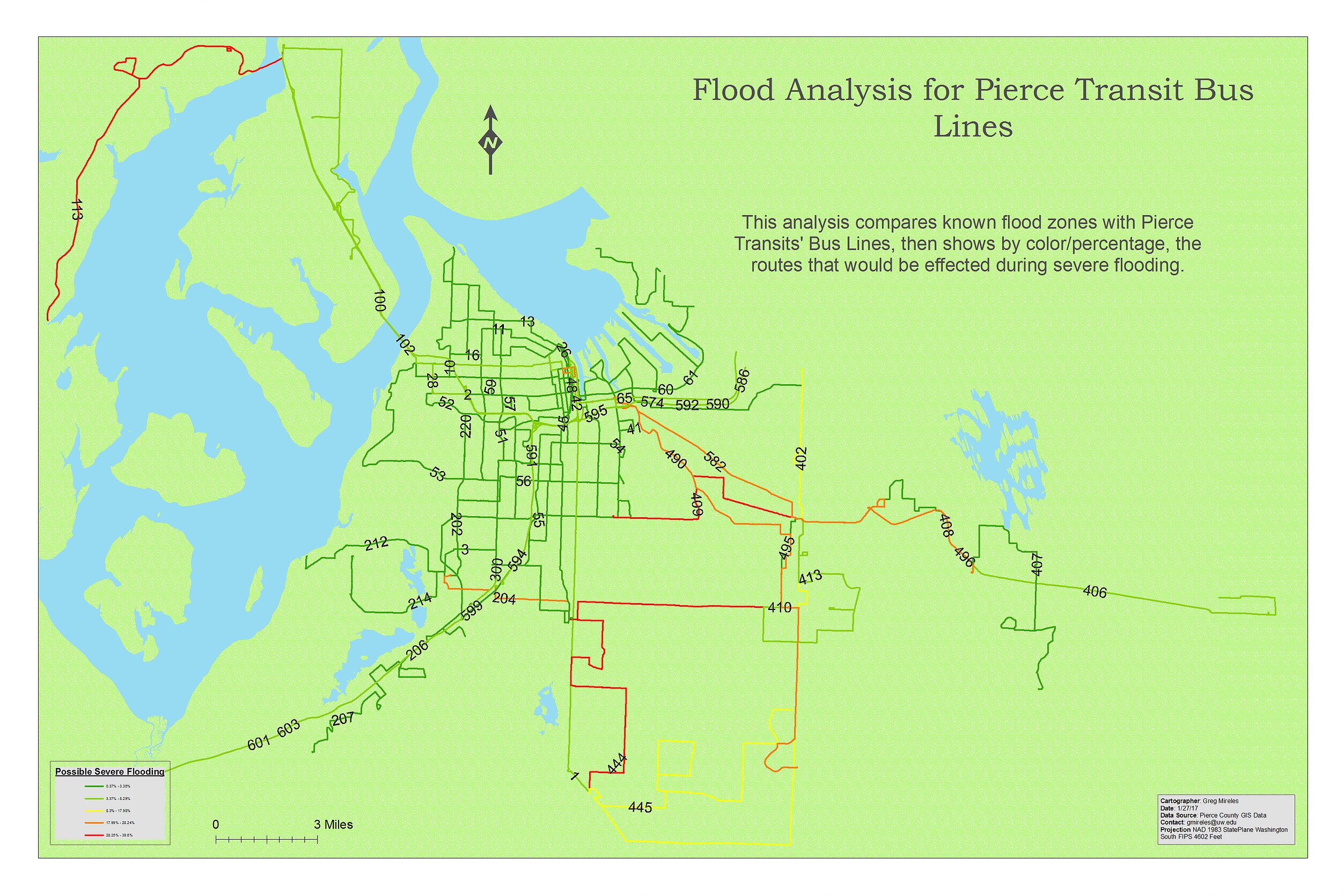
Flood Analysis
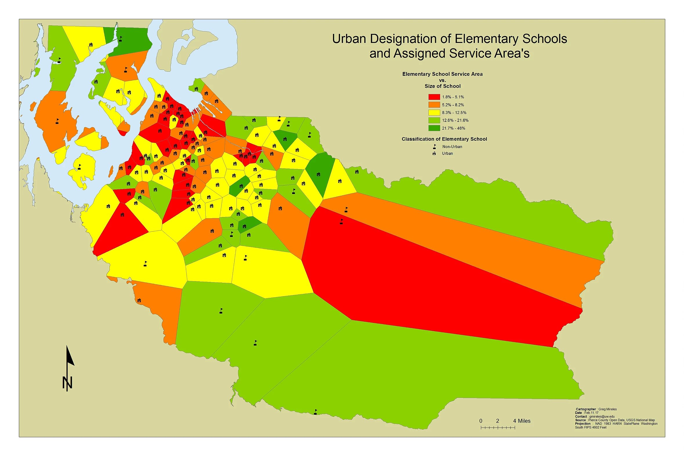
School Analysis
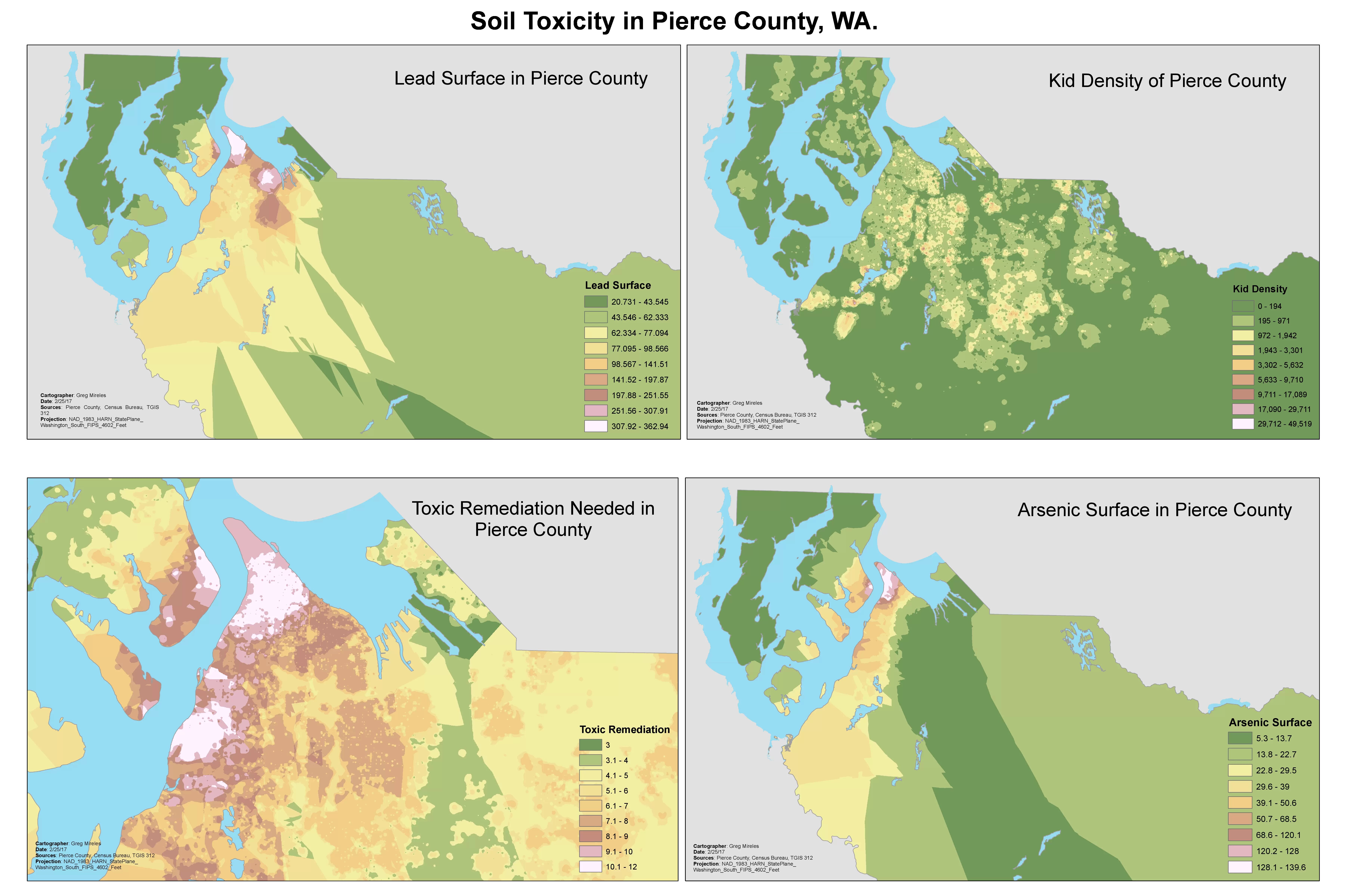
Toxic Analysis